Current (2015)
2014 2013
2012 2011
2010 2009
2008 2007
BabyBlogs
Majandra
Aliana
Travel Blogs
Europe/Egypt '06
Peru/Bolivia '08
Central Aust '09
Fiji '11
Cycling Maps & Routes
Links
Best viewed with Firefox

Site Built with gedit on Ubuntu
[Kings Canyon, Uluru & The Olgas, Northern Territory]
After seeing the Western MacDonnell Ranges, we headed back to Alice Springs. We grabbed some groceries and extra water, then started the 500 Km drive to Kings Canyon. The drive itself was quite uneventful, except of course for the 130Km/h speed limit on the Stuart Highway - how exciting!
-No-Porn.jpg)

We arrived at the Kings Canyon Resort camp ground around 5pm. There were lots of other cars and caravans there, we were lucky to get a good spot. We set up the van, freshened up, and headed to the sunset viewing platform which is within the camp ground itself. From the viewing platform you get a lovely view of the mountain range, which glows bright red in the sunset. Once we'd seen enough we went back to the van, had dinner, watched a movie on the laptop and got some sleep.
-Briony-at-Kings-Canyon-Resort-Caravan-Park.jpg)
-Briony-at-the-lookout-at-Kings-Canyon-Resort-Caravan-Park.jpg)
-View-from-the-lookout-at-Kings-Canyon-Resort-Caravan-Park.jpg)
-Briony-at-Kings-Canyon-Resort-Caravan-Park.jpg)
Kings Canyon
In the morning we headed out to do the Kings Canyon Rim Walk. Kings Canyon is 270m high and is situated within the Watarrka National Park. The car park is at the bottom of the canyon, so the first part of the walk is a track straight up a hill. It's got stairs made from rock so it's not too hard, but it sure is steep! Once at the top it's all reasonably flat for the rest of the 6Km walk. There are views of all sorts of rock formations including rocks with ripples that were once part of the sea bed.
-Kings-Canyon-Rim-Walk---First-Hill-to-climb.jpg)
-Kings-Canyon-Rim-Walk---Briony-up-the-hill.jpg)
-Kings-Canyon-Rim-Walk---Briony.jpg)
-Kings-Canyon-Rim-Walk---View-of-the-canyon.jpg)
-Kings-Canyon-Rim-Walk---Callan.jpg)
-Kings-Canyon-Rim-Walk---Briony.jpg)
-Kings-Canyon-Rim-Walk---Callan.jpg)
-Kings-Canyon-Rim-Walk.jpg)
A little way into the walk we came across Cotterill's Bridge, which takes you across a crevice to Cotterill's Lookout. This is just amazing as the lookout is literally on the edge of the cliff over looking the canyon. There are massive ghost gums in the canyon, and massive boulders, yet we were towering way above them. There is even a rocky ledge jutting out over the canyon and it's possible to walk on there but I thought better of it.
-Kings-Canyon-Rim-Walk---The-Canyon-&-Cotterill's-Bridge.jpg)
-Kings-Canyon-Rim-Walk---Rock-Face.jpg)
-Kings-Canyon-Rim-Walk---Callan-on-the-Edge.jpg)
Further into the walk there was still an awesome variety of scnery - right from the lush, green vegetation thriving at the bottom, right to the domes of the "Lost City" which are of course just eroded rock, but there are hundreds of them and they look like bee hives. The walk round the Lost City takes you to ther other side of the Canyon, so you get a different view of things.
-Kings-Canyon-Rim-Walk.jpg)
-Kings-Canyon-Rim-Walk.jpg)
-Kings-Canyon-Rim-Walk---Rock-Face.jpg)
Once the walk was finished, we headed back to van and started our drive to Uluru, with a lunch stop on the way of course!
Uluru & the Olgas
The drive to Uluru was just more of the same - a long way, with not many other cars around. From Kings Canyon it was around 160Km back to the Lasseter highway, then around 140Km to Yulara which is the town next to Uluru. On the way there's a big rock formation called Mount Connor - from a distance it's very easy to mistake it for Uluru as the shape is similar and you don't expect to see anoher big rock in the middle of nowhere!


We checked into the Ayers Rock Resort camp ground and relaxed with a cup of coffee and a book. At around 6 we headed into the national park ($25 per person for a threee-day pass) where there is a sunset viewing area. There were probably 100 cars there, all waiting to see the deep colours of Uluru in the sunset. After the sunset viewing we went back to the camp ground, had some dinner, watched some more Billie Piper :) and went to bed.
-Uluru-Sunset-Viewing.jpg)
-Uluru-Sunset-Viewing---Briony-&-Callan.jpg)
-Uluru-Sunset-Viewing.jpg)
The next morning we woke at 5:30 to make sure we got to the rock viewing area before dawn. We showered and headed straight into the national park. This was really quite amusing as there were heaps of cars (basically EVERYONE goes there for the dawn viewing) and this was causing a bit of a line up at the entry gate. There's one entry gate for cars, and another for tourist coaches which is clearly marked COACHES ONLY. We saw one car go that way - he stopped at the gate, got out and approached the "car" ticket window which held everyone up. Then the car of asians behind me pulled out and went into the coaches line. She went to the "car" window too, and just pretended not to understand english, while waving her tickets in the air. Then a third car went into the coaches line and the ticket lady was telling the guy off. When she said about that line being coaches only, his stupid excuse was "oh, sorry, I thought that also meant vans" since he was driving a van. Conclusion - people are annoying twats.
The dawn viewing area was really busy, and full of tour groups. It was quite cold outside, most people were wearing jackets. The tour groups were having their breakfast and coffee at the viewing area. We hung around and grabbed some photos, the rock really was quite pretty in the morning sun.
-Briony-in-the-Camper-Van.jpg)
-Uluru-Dawn-Viewing---Callan.jpg)
-Uluru-Dawn-Viewing---Callan.jpg)
-Uluru-Dawn-Viewing---Briony.jpg)
-Uluru-Dawn-Viewing.jpg)
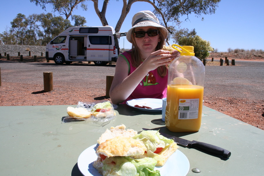
Once everyone had left the viewing area, we sat in the van and had our breakfast. On every holiday there's at least one crying session and today was the day. Briony was having a whinge that I finished too much orange juice, so I told her to shut up, and we had tears for the next half hour. She was all good in the end though, and we got ready for our Uluru base walk. This is the two-hour-ish walk around the base of Uluru - about 10Km all up, it's huge!
We started the walk at the eastern end car park, close to the Kuniya Piti sacred site. This was the car park closest to the sunrise viewing area. We did the walk in a clockwise direction, starting round the southern side of the rock which was in shade the whole way. This was really pretty with heaps of trees and plants and even a (dry) waterhole.
-Uluru-Base-Walk.jpg)
-Uluru-Base-Walk---Callan.jpg)
-Uluru-Base-Walk---Briony.jpg)
-Uluru-Base-Walk.jpg)
At the western side there is a place where it's possible to climb to the top of Uluru. There were heaps of people doing it, but the traditional owners of this area have asked the rock not be climbed as it's sacred, so we respected those wishes and chose not to climb.
-Uluru-Base-Walk---Rock-Climb-Tourists.jpg)
-Uluru-Base-Walk---Rock-Climb-Tourists.jpg)
Once we got round to the western/northern side we were in full sun but this was only around 9am so it wasn't particularly hot. There seemes to be less vegetation here, but perhaps this was just an illusion because the walking track on the northern side is perhaps 100-200 metres from the rock itself - quite different to the southern side where the rock is literally right next to the track.
-Uluru-Base-Walk---Briony.jpg)
-Uluru-Base-Walk---Briony.jpg)
-Uluru-Base-Walk.jpg)
I have to admit that while the walk was good, we were 'over it' about half way round - we'd seen enough, but there was still a long way to go! Anyway we finally got to the end, had a big drink from the drinking water tank there, then made some lunch in the camper van.
-Uluru-Base-Walk.jpg)
-Uluru-Base-Walk---Callan.jpg)
From Uluru we made a quick toilet stop at the cultural centre, then drove 50Km to the Olgas. There is a sand dune viewing platform along the way so of course we stopped for some photos. It was possible to see both the Olgas and Uluru from here. What was odd though, were the three bizarre tourists, I think they were Brazilian. The male was sitting on the fence ledge looking way too cool with his cowboy hat, and the female was wearing practically a bikini and posing so the cowboy-hat male could take her photo. There was another female too, not quite so outrageous. Oh well, at least we got to see the Olgas, Uluru and some way-too-enthusiastic tourists :)
-Briony-&-Callan-with-Uluru.jpg)
-Kata-Tjuta-(The-Olgas).jpg)
-Kata-Tjuta-(The-Olgas).jpg)
We got to the Olgas and did the shorter of the two walks. The Valley of the Winds walk would have been nice but it was 12Km, and we'd already done enough walking for one day! So we did the Gorge walk which was about 2.5Km return, really easy and still quite pretty. I guess the gorge area was like Kings Canyon ... except we were at the bottom rather than up top.
-Kata-Tjuta-(The-Olgas).jpg)
-Kata-Tjuta-(The-Olgas).jpg)
-Kata-Tjuta-(The-Olgas).jpg)
-Kata-Tjuta-(The-Olgas)---Briony.jpg)
Next : Woomera, Roxby Downs & Andamooka, South Australia
or, back to Central Australia 2009 Index
Site created by Callan Davies / CRUZN 2007-2010
Some content protected. Other content free for your use. Contact the Webmaster
Random Photo:


[Articles]
Talking to the Topfield TF5000PVRt using Linux and ftpd-topfield
Setting up DynDNS in Ubuntu/Linux
Restore GRUB boot manager after Windows destroyed it